Access now

Language

A sailor on a harbour quay reads the app on her phone in the morning light

Generated image (AI)

The forecast, worked out for your boat

Seadromy plans your voyages, routes your crossings and prepares your deliveries in the Mediterranean, from the forecast for your dates and our base of 9,776 anchorages and ports.

Access now

  • Each night in an anchorage or port sheltered from that night's wind and swell
  • Room to anchor for your draught, from the depth around each stop
  • Sail or engine, fuel range and refuelling stops worked out
  • 10 credits offered, no subscription

Three ways to sail with Seadromy

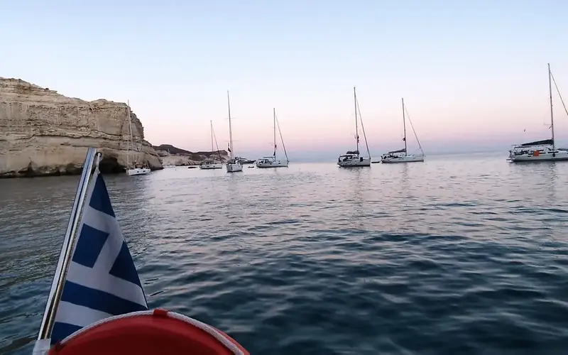
Sailing boats at anchor at dusk

Voyages

Several days, every night sheltered

Your port, your days, the places you dream of: the app lays out the voyage day by day, with when to leave and where to spend the night.

  • Nights chosen for that night's wind and swell
  • A night in port taken for shelter when a gale comes
  • Fuel for each leg, and where to fill the tank

3 credits per voyage, whatever its length

Plan a voyage
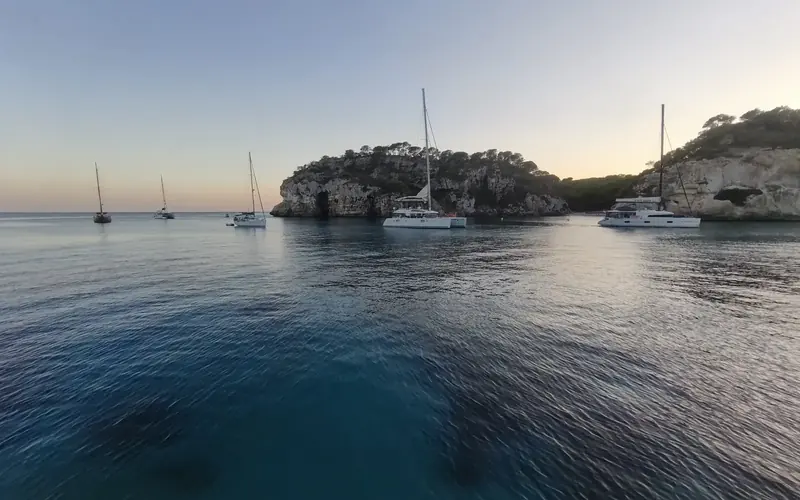
A calm sea at sunrise, boats at anchor

Crossings

One passage, routed for your boat

From A to B with your boat's polar: the track, the tacks, sail or engine, the wind and the swell all along the way.

  • The best departure over the next 3 days
  • The nearest departure that arrives in daylight
  • Where to refuel when the tank runs short

From 1 credit per crossing

Route a crossing
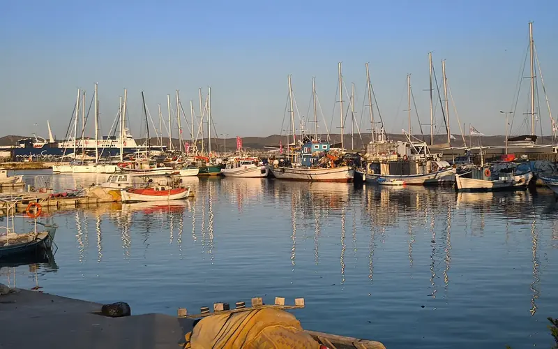
A harbour at first light, before leaving

Deliveries

A boat to deliver, far away

Departure, arrival, time of departure, no arrival date: the app prepares the stages, the fuel and the stops on the way.

  • Non-stop when the weather and the fuel allow
  • Mandatory stops only for the weather or the fuel, each with its cause
  • Proposed stops, fuel stations first: accept or refuse, free
  • Tank and jerrycans counted, a safety reserve kept
  • Each leg routed in detail, recomputed from the stage you reach

5 credits per delivery, whatever its length

Plan a delivery

What the app does for you

Real screens of the app, computed with real forecasts.

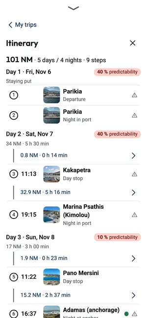
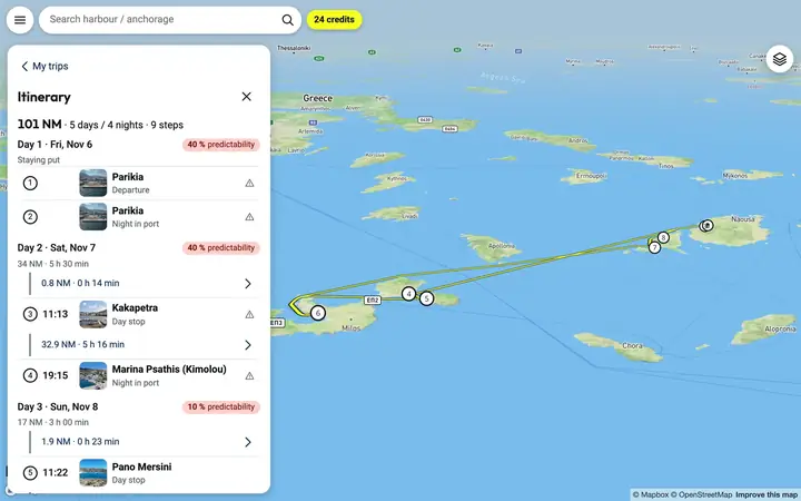
  • The voyage, day by day

    Each day says where you sail, when you leave and when you arrive. Each night falls in an anchorage or a port sheltered from that night's wind.

    The voyage, day by day – Phone – the Cyclades from Paros
    The voyage, day by day – Computer – the Cyclades from Paros
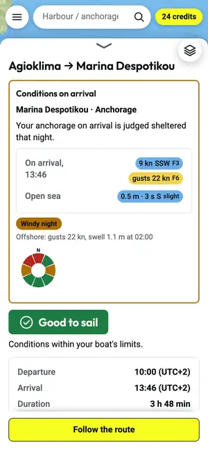
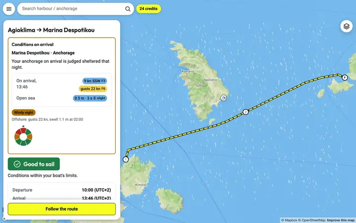
  • Each crossing routed with the wind

    A leg can be routed in detail for your boat: the track, the tacks, sail or engine, wind and swell all along the way.

    Each crossing routed with the wind – Phone – the Cyclades from Paros
    Each crossing routed with the wind – Computer – the Cyclades from Paros
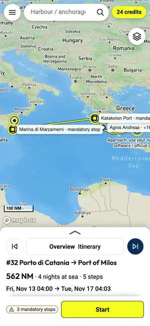
  • Deliveries: the stage plan to the arrival

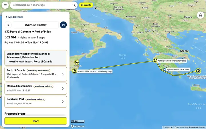
    A boat to take far away: the app goes non-stop when it can, stops for the weather or the fuel only when it must, and proposes stops with a fuel pump that you accept or refuse. Each leg is then routed in detail.

    A delivery computed by the app: Catania to Milos, its fuel stops and a weather wait in port – Phone
    A delivery computed by the app: Catania to Milos, its fuel stops and a weather wait in port – Computer
  • A card for every place

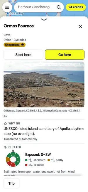
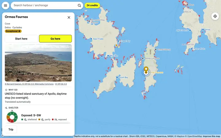
    Shelter by wind direction, seabed and depth, what is ashore, a photo and the places nearby: everything to choose tonight's anchorage.

    A card for every place – Phone – the Cyclades from Paros
    A card for every place – Computer – the Cyclades from Paros
  • Navigation mode, by night too

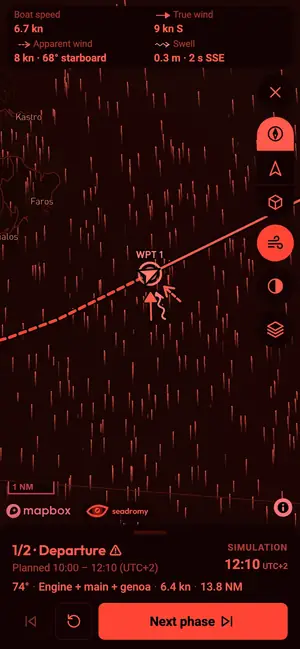
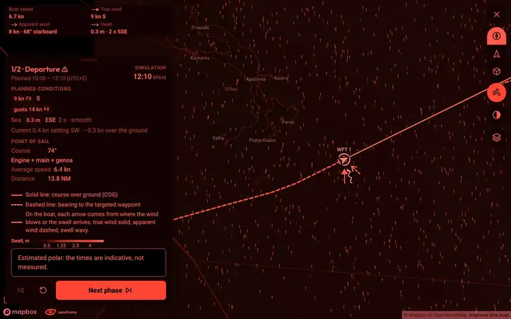
    Under way, the app follows your position along the route: course to steer, point of sail and tack, distance and time to the next waypoint. It warns you when you leave the route or when the forecast has moved. At night the screen turns red on black to keep your night vision.

    Navigation mode, by night too – Phone – the Cyclades from Paros
    Navigation mode, by night too – Computer – the Cyclades from Paros
  • It knows your boat

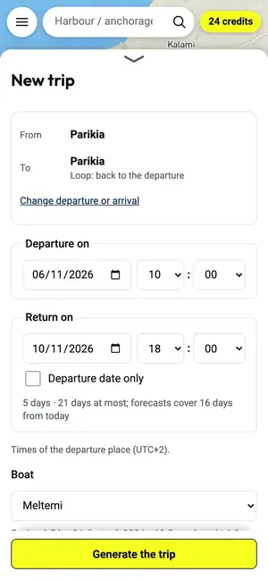
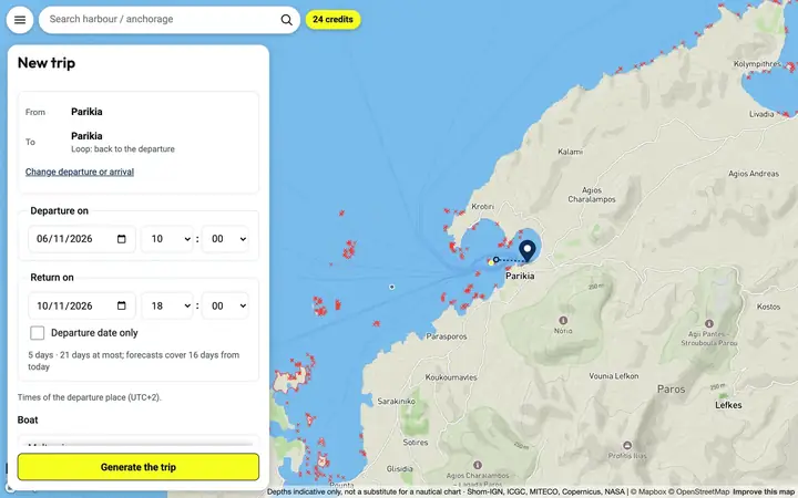
    Its polar (estimated from type and length, or your polar file or ORC certificate), its draught, its tank, its consumption and its jerrycans.

    Your boat, your port, your dates – Phone – the Cyclades from Paros
    Your boat, your port, your dates – Computer – the Cyclades from Paros

Pay for what the engine computes

The app runs on credits, charged by what its engine computes for you. No subscription: buy credits when you need them. You only pay for what you use.

Three packs, one-off payment

Discovery

20 credits for €10

Cruise

60 credits for €25

Season

150 credits for €50

What credits buy
CalculationCredits
Plan a voyage, whatever its length3
Recompute a voyage with the new forecast2
Route a crossing in detail for your boat1
Find the best departure over the next 3 days2
Find the nearest departure that arrives in daylight1
Plan a delivery, whatever its length5
Recompute a delivery from a stage3

Example: planning a voyage, then routing its 4 longest crossings in detail, costs 7 credits.

  • 10 credits offered when you create your account
  • No subscription, nothing to cancel.
  • Credits stay valid 12 months after purchase.
  • A calculation that fails costs nothing: its credits come back automatically.
  • Card payment, VAT included, with an invoice.

Questions

What does the app cost?

No subscription: 10 credits are offered when you create your account, then packs of credits from €10. A voyage costs 3 credits, a crossing from 1, a delivery 5.

Where does it work?

In the Mediterranean, from our base of 9,776 anchorages and ports.

On which devices?

The app works now in the browser of your phone, tablet or computer. The Android and iPhone apps are on their way.

Does it know my boat?

Its polar (estimated from type and length, or your polar file or ORC certificate), its draught, its tank, its consumption and its jerrycans.

And if the forecast changes?

Recompute a voyage for 2 credits, or a delivery from the stage you have reached for 3 credits, with the new forecast.

And if a calculation fails?

A calculation that fails costs nothing: its credits come back automatically.

Does it replace the nautical chart?

No. Shelter, depth and seabed are computed estimates: always check the nautical chart, the local rules and the conditions on site.

Plan your next voyage

The app works now in the browser of your phone, tablet or computer. The Android and iPhone apps are on their way.

Access now

Access now