
Salt Basin
port · Port Fuad · Libya and Egypt
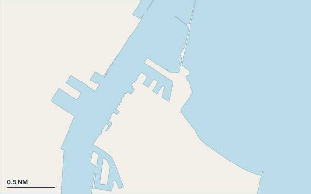
Salt Basin is a port on the coast of Libya and Egypt.
The nearest town is Port Fuad.
Shelter by wind direction
Good shelter in east and west wind.
Partial shelter in north (tramontana), north-east, south-east (sirocco), south, south-west and north-west wind.
Swell can come in from south to south-south-west (188°–196°).
Swell can come in from north to north (352°–4°).
- sheltered
- partly
- exposed
Shelter is estimated from open water and swell, not from wind strength: a strong wind can still gust over the land.
Here, shelter depends on tonight's wind. Seadromy reads the forecast and tells you before you leave.
Seabed, depth and room
Satellite imagery shows light, sandy patches around the anchoring spot.
Good holding.
Approach
Approach through a channel or a harbour entrance: routes end about 4.3 NM off, then continue at reduced speed.
Protected area and seagrass
Libya: sailing not advised (security), go through an agent. Egypt: cruising permit and coast guard checks.
Where to go when the wind turns
When the wind makes this place exposed, the nearest places rated as well sheltered are:
- In north wind: Hussein Basin, 0.1 NM by sea.
- In north-east wind: Hussein Basin, 0.1 NM by sea.
- In south-east wind: Hussein Basin, 0.1 NM by sea.
- In south wind: Hussein Basin, 0.1 NM by sea.
- In south-west wind: Hussein Basin, 0.1 NM by sea.
- In north-west wind: Hussein Basin, 0.1 NM by sea.
Nearby anchorages and ports
- Hussein Basin port · 0.1 NM by sea
- Port Said port · 2.9 NM by sea
- SCCT port · 3.2 NM by sea
Questions
Is Salt Basin sheltered from the tramontana?
Partly. Shelter is rated fair in north wind. The nearest well-sheltered place is Hussein Basin, 0.1 NM by sea.
Is Salt Basin sheltered from the sirocco?
Partly. Shelter is rated fair in south-east wind. The nearest well-sheltered place is Hussein Basin, 0.1 NM by sea.
What is the seabed at Salt Basin?
Satellite imagery shows light, sandy patches around the anchoring spot. Good holding.
Can you spend the night at Salt Basin?
Yes, it is a port: check berth availability and book ahead in summer.