
es Aloquets
cove · Minorca
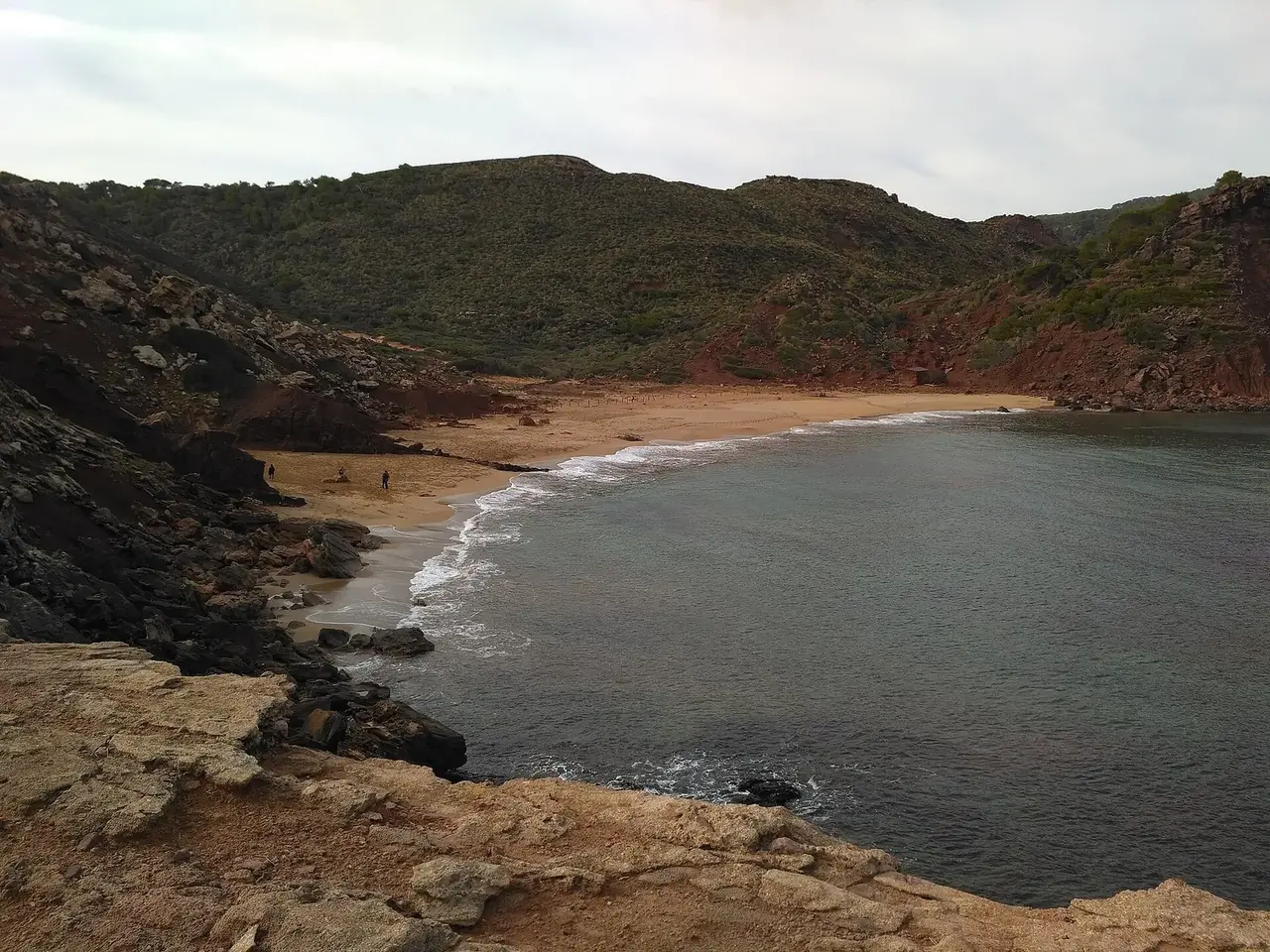

es Aloquets is a cove on the coast of Minorca.
Minorca is part of the Balearic Islands.
The bay opens towards the north (358°).
Shelter by wind direction
Good shelter in south-east (sirocco), south and south-west wind.
Partial shelter in east and west wind.
No shelter in north (tramontana), north-east and north-west wind.
In the most open sector, up to 30 NM of open water towards the north.
Swell can come in from west-north-west to east-north-east (300°–60°).
- sheltered
- partly
- exposed
Shelter is estimated from open water and swell, not from wind strength: a strong wind can still gust over the land.
Here, shelter depends on tonight's wind. Seadromy reads the forecast and tells you before you leave.
Seabed, depth and room
Seabed: sand.
Source: official seabed habitat map of the Balearic government.
Satellite imagery shows light, sandy patches around the anchoring spot.
Good holding.
Depth near the anchoring spot: about 4 m (EMODnet bathymetry, indicative).
Room to anchor: medium (about 3.5 ha).
Approach
Direct approach from open water; the routing point lies 0.2 NM from the anchoring spot.
Ashore and services
Gravel beach.
No road nearby.
Almost no buildings ashore (0 within 600 m).
Nothing ashore: a wild anchorage.
Where to go when the wind turns
When the wind makes this place exposed, the nearest places rated as well sheltered are:
- In north-east wind: Puig Tremolor, 3.5 NM by sea.
- In east wind: Cala Barril, 2.1 NM by sea.
- In west wind: Cala de ses Fontanelles, 3.5 NM by sea.
- In north-west wind: Cala Pregonda, 3.7 NM by sea.
Nearby anchorages and ports
- els Alocs cove · 0.1 NM by sea
- Cala del Pilar anchorage · 0.1 NM by sea
- sa Bombarda cove · 0.5 NM by sea
- Caló de n'Alforinet cove · 1.5 NM by sea
- Cala en Calderer cove · 1.7 NM by sea
- Racó des Llenyam cove · 1.9 NM by sea
Sheltered anchorages of Minorca by wind
More places – Minorca
- Ses Llentaines cove
- Fornells-Ses Salines anchorage
- Bèrecs de Santa Anna cove
- Cala Moro cove
Questions
Is es Aloquets sheltered from the tramontana?
No. It is exposed in north wind.
Is es Aloquets sheltered from the sirocco?
Yes. Shelter is rated good in south-east wind.
How deep is the water at es Aloquets?
Depth near the anchoring spot: about 4 m (EMODnet bathymetry, indicative).
What is the seabed at es Aloquets?
Seabed: sand. Source: official seabed habitat map of the Balearic government. Satellite imagery shows light, sandy patches around the anchoring spot.
Can you spend the night at es Aloquets?
It depends on the wind of the night: Seadromy picks the evening anchorage with the forecast of the day.