
Isola dei Cavoli
mooring field · Cavoli Island · Sardinia
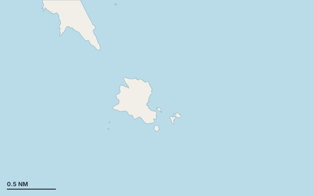
Isola dei Cavoli is a mooring field on the island of Cavoli Island, in the Sardinia cruising area.
The bay opens towards the east-north-east (67°).
Shelter by wind direction
Good shelter in north-west wind.
Partial shelter in south, south-west and west wind.
No shelter in north (tramontana), north-east, east and south-east (sirocco) wind.
In the most open sector, up to 30 NM of open water towards the north-east.
Swell can come in from north-north-east to north-east (24°–40°).
Swell can come in from north-east to east-south-east (52°–116°).
- sheltered
- partly
- exposed
Shelter is estimated from open water and swell, not from wind strength: a strong wind can still gust over the land.
Here, shelter depends on tonight's wind. Seadromy reads the forecast and tells you before you leave.
Seabed, depth and room
Seabed: posidonia, sand and rock.
Seabed to avoid for the anchor.
Depth near the anchoring spot: about 11.8 m (EMODnet bathymetry, indicative).
Approach
Direct approach from open water; the routing point lies 0.1 NM from the anchoring spot.
Protected area and seagrass
Isola dei Cavoli lies in the protected area Zona di Protezione Speciale Capo Carbonara: check its rules (anchoring, speed, buoys) before you arrive.
Posidonia seagrass is present: drop the anchor on sand only.
Ashore and services
Nearest services:
- Gavitelli di ormeggio Isola dei Cavoli (NOL_13-19D) · up to 24 m · Book online at www.ampcapocarbonara.it
Where to go when the wind turns
When the wind makes this place exposed, the nearest places rated as well sheltered are:
- In north wind: Spiaggia di Porto Giunco, 1.7 NM by sea.
- In north-east wind: Cala Burroni, 2.8 NM by sea.
- In east wind: Cala Burroni, 2.8 NM by sea.
- In south-east wind: Marina di Villasimius, 3.1 NM by sea.
- In south wind: Marina di Villasimius, 3.1 NM by sea.
- In south-west wind: Spiaggia di Capo Carbonara - Cava Usai, 1.5 NM by sea.
- In west wind: Spiaggia di Capo Carbonara - Cava Usai, 1.5 NM by sea.
Nearby anchorages and ports
- Spiaggia di Capo Carbonara - Cava Usai cove · 1.5 NM by sea
- Spiaggia di Porto Giunco anchorage · 1.7 NM by sea
- Spiaggia di Villasimius cove · 2.2 NM by sea
- spiaggia di Is Traias cove · 2.3 NM by sea
- Porto Luna cove · 2.5 NM by sea
- Punta Molentis mooring field · 2.6 NM by sea
Sheltered anchorages of Sardinia by wind
More places – Cavoli Island
- Villaggio Colostrai cove
- Àcua Durci cove
Questions
Is Isola dei Cavoli sheltered from the tramontana?
No. It is exposed in north wind. The nearest well-sheltered place is Spiaggia di Porto Giunco, 1.7 NM by sea.
Is Isola dei Cavoli sheltered from the sirocco?
No. It is exposed in south-east wind. The nearest well-sheltered place is Marina di Villasimius, 3.1 NM by sea.
How deep is the water at Isola dei Cavoli?
Depth near the anchoring spot: about 11.8 m (EMODnet bathymetry, indicative).
What is the seabed at Isola dei Cavoli?
Seabed: posidonia, sand and rock. Seabed to avoid for the anchor.
Can you spend the night at Isola dei Cavoli?
It depends on the wind of the night: Seadromy picks the evening anchorage with the forecast of the day.