
Faraglione Est
mooring field · Favignana · Sicily
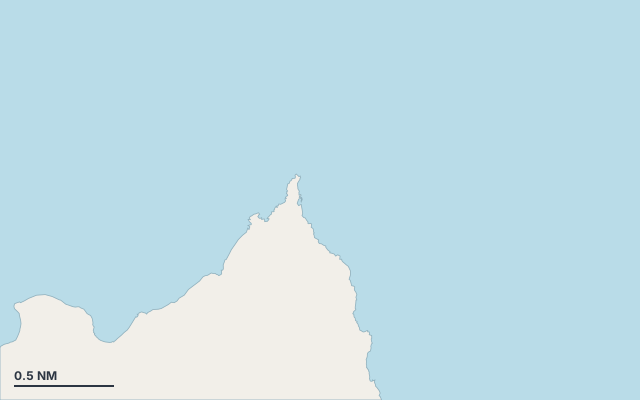
Faraglione Est is a mooring field on the island of Favignana, in the Sicily cruising area.
Favignana is part of the Aegadian Islands.
Also known as Cala Trapanisa.
The bay opens towards the north-east (51°).
Shelter by wind direction
Good shelter in south, south-west and west wind.
No shelter in north (tramontana), north-east, east, south-east (sirocco) and north-west wind.
In the most open sector, up to 30 NM of open water towards the north.
Swell can come in from north-east to east-south-east (44°–120°).
Swell can come in from north-north-west to north-north-east (336°–12°).
- sheltered
- partly
- exposed
Shelter is estimated from open water and swell, not from wind strength: a strong wind can still gust over the land.
Here, shelter depends on tonight's wind. Seadromy reads the forecast and tells you before you leave.
Seabed, depth and room
Depth near the anchoring spot: about 9.2 m (EMODnet bathymetry, indicative).
Room to anchor: large (about 78.5 ha).
Approach
Direct approach from open water; the routing point lies 0.1 NM from the anchoring spot.
Protected area and seagrass
Faraglione Est lies in the protected area Riserva naturale marina Isole Egadi — Zona B: check its rules (anchoring, speed, buoys) before you arrive.
Posidonia seagrass is present: drop the anchor on sand only.
Ashore and services
Nearest services:
- Campo ormeggio Faraglione Est (Zona B, Isola di Favignana) · up to 24 m · Book online at www.ampisoleegadi.it
Local rules
- The whole marine protected area is subject to authorisation by the managing body (Comune di Favignana) for anchoring, mooring to buoys, diving and commercial activities; jet skis, water skiing and similar sports prohibited in zones A, B and C (jet skis may only transit perpendicular to the coast, 5 knots in zone B).
- Zone B: within 500 m of the coast, motor navigation, anchoring and mooring are reserved, with authorisation, for the natanti of residents/home owners of Favignana (excluding seabeds of interest); at Marettimo, up to 40 non-resident natanti per day with a daily authorisation (€10/day) for navigation and anchoring. (To be checked)
- In the buoy fields: mooring only to the allocated buoy (or a buoy of its category), one vessel per buoy, with a paid authorisation; anchoring, free navigation and stopping away from a buoy prohibited; swimming prohibited; mooring prohibited in bad weather. (To be checked)
Translated automatically
Where to go when the wind turns
When the wind makes this place exposed, the nearest places rated as well sheltered are:
- In north wind: Cala Camaro, 2.1 NM by sea.
- In north-east wind: Cala Rotonda, 4.2 NM by sea.
- In east wind: Praia, 1.3 NM by sea.
- In south-east wind: Praia, 1.3 NM by sea.
- In north-west wind: Porticciolo di Levanzo, 2.3 NM by sea.
Nearby anchorages and ports
- Faraglione Ovest mooring field · 0.8 NM by sea
- Praia cove · 1.3 NM by sea
- Cala Graziosa cove · 1.7 NM by sea
- Cala San Nicola cove · 2.1 NM by sea
- Cala Camaro cove · 2.1 NM by sea
- Porticciolo di Levanzo marina · 2.3 NM by sea
Sheltered anchorages of Sicily by wind
More places – Favignana
- Cala Sant'Antonio cove
- Bue Marino mooring field
- Faraglione Ovest mooring field
- Scindo Passo mooring field
Questions
Is Faraglione Est sheltered from the tramontana?
No. It is exposed in north wind. The nearest well-sheltered place is Cala Camaro, 2.1 NM by sea.
Is Faraglione Est sheltered from the sirocco?
No. It is exposed in south-east wind. The nearest well-sheltered place is Praia, 1.3 NM by sea.
How deep is the water at Faraglione Est?
Depth near the anchoring spot: about 9.2 m (EMODnet bathymetry, indicative).
What is the seabed at Faraglione Est?
Room to anchor: large (about 78.5 ha).
Can you spend the night at Faraglione Est?
It depends on the wind of the night: Seadromy picks the evening anchorage with the forecast of the day.