

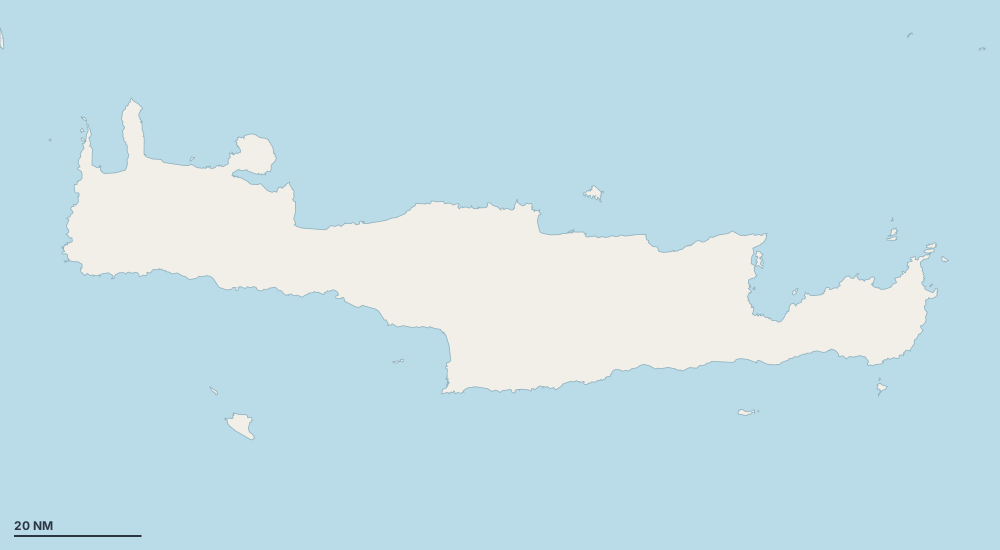
Karte – Crete
Wählen Sie eine Insel, eine Küste oder einen Ort auf der Karte.
 GavdosPaleochoraAgios NikolaosIerapetraGaziSpiliChaniaMaliaRethymnonKounoupidianaTymbakiPalaekastroFrangokastelloSitiaLimenas ChersonisouChora SfakionSelliaLoutroKissamosKalo NeroBaliAgia GaliniMirtosSoudaNeapoliAgios IoannisChrysiSchinokapsalaLentasSpinalonga-HalbinselAnalipsiAno RodakinoSidoniaAgia RoumeliBalos BeachBelegrinaLivadi beachLoutroYachthafen ElountaYachthafen ChaniaKlein Triopetra (Strand)Palmenstrand von VaiStrand von PreveliRed BeachVenetian HarbourAgia FotiaAgia Pelagia BeachAnalipsiDiktina BeachKommos StrandMadeYachthafen von RethymnoYachthafen SitiaYachthafen Agia GaliniYachthafen Agios NikolaosYachthafen IerapetraYachthafen von PaleochoraYachthafen PlakiasMirabelloMochlosMatalaPalm Bay BeachRosa SandstrandPotamos municipal beachRethymnon BeachSandstrandSarakinikoSkinaria (Strand)Sougia BeachSunset BeachThodoradonTiny beach pink sandTriopetra BeachVarkotopos beachAgia KyriakiAmatos beachBotzalaki beachEastern GulfFodele BeachKalimera BeachKataprosopoKolimbariKolokythaKorfosLimani GavdouLoutrakiMalia MarinaYachthafen Kokkinos PyrgosYachthafen MakrygialosMarina of PanormosMarina of SisiMazida Ammos beachMyrtos MarinaAlter HafenOmbrosgialosPahia Ammos Nudist BeachPolyrizos (Strand)PyrgosSaradari Nude BeachSisiTholos BeachTrachilias BeachTrypitiVlyhada beachVoulismaBali MarinaKato ZakrosKedrodasosLigres (Strand)Yachthafen von Chora SfakionMarmara BeachMirtosOrmos PotamosParalia Potamos
- Hafen oder Marina
- Bucht oder Ankerplatz
- Bojenfeld
- Außergewöhnlich
Inseln und Küsten
Paleochora
10
Agios Nikolaos
10
Spili
8
Rethymnon
6
Kounoupidiana
6
Palaekastro
5
Frangokastello
5
Limenas Chersonisou
4
Chora Sfakion
4
Loutro
4
Weitere Orte an der Küste
98
- Agia Roumeli
- Balos Beach
- Loutro
- Klein Triopetra (Strand)
- Palmenstrand von Vai
- Venetian Harbour
- Diktina Beach
- Yachthafen Plakias
- Mochlos
- Rosa Sandstrand
- Skinaria (Strand)
- Sougia Beach
- Tiny beach pink sand
- Triopetra Beach
- Amatos beach
- Botzalaki beach
- Fodele Beach
- Kolimbari
- Yachthafen Makrygialos
- Marina of Panormos
- Mazida Ammos beach
- Ombrosgialos
- Marina bei Plaka
- Marina bei Platanias
- Tholos Beach
- Vlyhada beach
- Kato Zakros
- Kedrodasos
- Paralia Potamos
- Agios Nikitas
- Agios Panteleimon
- Agios Sostis
- Alatsolimni beach
- Aliori
- Almyrida
- Ammofolos Strand
- Arvi Marina
- Asprolithos
- Kap Agios Ioannis
- Caves
- Caves of Skaleta
- Chrysostomos
- Strand von Damnoni
- Dermatos
- Domata beach
- Episkopi Strand
- Falassarna Dünenstrand
- Faskomilia
- Ferma
- Finikidia (Strand)
- Geropotamos beach
- Hohlakas
- Itanos Beach
- Kalami beach
- Kali Limenes
- Kallikovrechtis
- Karavovrysi
- Karoumes
- Karterou
- Kato Selle
- Kendrodasos
- Kera
- Keratokambos
- Keratokambos
- Kokkines Plakes
- Korakas (Strand)
- Krassas beach
- Krinakia beach
- Kyriamadi
- Leprias
- Linares
- Listis
- Livari beach
- Makria Ammos
- Melissa Sandhills
- Mononaftis Beach
- Neos Myrtos
- Pachia Ammos
- Pachia Ammos
- Palaria
- Paligremnos (FKK-Strand)
- Paralia Katevati
- Paralia Maufomouri
- Paralia Vlychadia
- Pera Galini
- Pera Koutelos
- Poros
- Sendoni
- Skouros
- Sougia
- Stavromeno
- Stena
- Sweet Kolymbos
- Tripti
- Tris Ekklisies
- Tsifliki
- Vourlia beach
- Xoticospilio
Geschützte Ankerplätze nach Wind
- Schutz vor dem Meltemi (Nord)
- Schutz vor dem Gregale (Nordost)
- Schutz vor dem Levante (Ost)
- Schutz vor dem Schirokko (Südost)
- Schutz vor dem Ostro (Süd)
- Schutz vor dem Libeccio (Südwest)
- Schutz vor dem Ponente (West)
- Schutz vor dem Mistral (Nordwest)
Segelreviere in der Nähe
- Karpathos und Kasos 43
- Cyclades 451
- Dodecanese 117
- Southern Peloponnese 171
- Rhodes 42
- Saronic Gulf 200